
As I said in my previous post, we took a six hour ferry to get to Port aux Basques, Newfoundland, so let me begin this post by mentioning a couple of things about Newfoundland itself. I suspect most people have heard of the individual regions of Newfoundland and Labrador. Newfoundland and Labrador became the tenth province to enter the Canadian Confederation on March 31, 1949. The province was named “Newfoundland”. An amendment was made to the Constitution of Canada on December 6, 2001, to change the name of the province to “Newfoundland and Labrador”. Labrador is part of the North American mainland with the province of Quebec neighboring it to the west and south. Newfoundland is an island and the only way to get to Newfoundland is by boat or plane. We figured that the truck and travel trailer wouldn’t qualify as carry-on luggage, so a ferry ride seemed to be the best option. There are roads from Quebec to Labrador, or we could have taken a ferry to Labrador from Newfoundland, but it seems the roads are mostly gravel (because of the harsh weather conditions) and we figured we had enough of gravel roads when we traveled the Dempster highway in Yukon and Northwest Territories back in 2013. The roads in Newfoundland are mainly asphalt and aren’t the best, but there are plenty of “pothole” signs warning drivers to slow down at those sections. There is one main highway the crosses Newfoundland west to east (or vice versa if you’re traveling in that direction) and that’s what we took as we left JT Cheeseman Provincial Park at 7:45 AM NT on June 14. It was mostly sunny and cool when we left with the temperature in the mid to upper 40’s at the time.
Now, we didn’t notice many tourist stops that captured our attention as we drove the highway. We simply enjoyed the drive itself. Newfoundland doesn’t have quite the number of trees as the three other provinces have that we had visited so far this trip. The landscape was more open with interesting rock formations, some big lakes, and rivers/streams running between the lakes. It was good to be able to actually see the terrain and it reminded us “somewhat” of western Canada, although the mountains in western Canada are certainly higher and more angular. The distance to travel from one end of Newfoundland to the other is approximately 560 miles. We decided to do this in two days, so our first stop for the night would be at Sanger Memorial RV Park in Grand Falls-Windsor, Newfoundland. This is a very nice city park that sits along the Exploits River. The Exploits River is the longest river in Newfoundland. We would have enjoyed walking around the place some if it wasn’t for the fact that it was cold. The temperature was in the low 40’s, it was cloudy, and there was a wind chill that we hadn’t experienced for quite a few months. We set up camp and truly appreciated the heater inside the travel trailer. We did have to stop at a Walmart to pick up a few odds and ends, purchase some diesel, and then stopped at a KFC to get some food for dinner. KFC’s in Canada are rather interesting. In the States, it’s common to order mashed potatoes with the meal, but in Canada, mashed potatoes aren’t on the menu. I’ve seen that in other Canadian provinces, not just Newfoundland. The potatoes at these KFCs are French fries. You can have gravy on top of your French fries (if you add cheese curds and gravy to French fries, it’s called poutine), or just eat them plain. We did the latter.
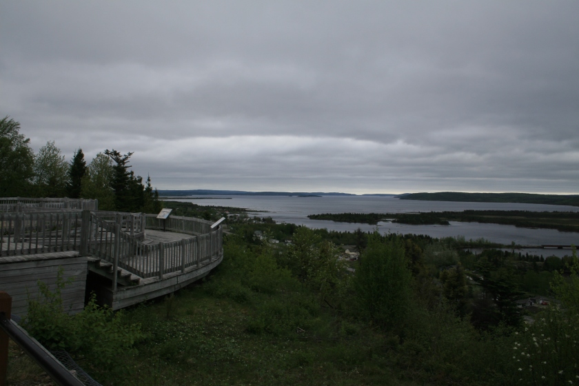
It did get down to just above freezing the next morning, but the wind died down, so it was almost pleasant when we broke camp. I think it was 38 degrees as we left the campground, which was about 8:45 AM NT. Along the way, we stopped at a place called Joey’s Lookout and took a few photos of the scene.
…

…

…

This highway eventually takes you through a park called Terra Novo National Park which is on the eastern side of the island. It was here that we saw a black bear walking along the side of the road. Unfortunately, we didn’t get a photo. Sorry. We still hadn’t seen a moose yet on this trip either. We saw plenty of Moose crossing signs, although not so much in Newfoundland, but still no moose. Hmm. We drove the rest of the way in Newfoundland to the city of St John’s and set up camp at Pippy Park Campground at 2 PM NT on June 15. This was another nice campground and, it was a bit warmer here. After setting up camp, we drove to a little mall so my husband could get a postcard of an iceberg to send to his Dad for Father’s Day.
Many of the early settlers in Nova Scotia came from Scotland. (Nova Scotia = New Scotland.) You could hear a bit of a brogue from the folks in Nova Scotia. However, many of the early settlers to St John’s, Newfoundland came from Ireland and you could definitely hear an Irish brogue. We wanted to go to an Irish pub in St John’s and drove to the downtown section of the city which has tons of Irish pubs. It wasn’t far to get to the downtown area, but St John’s is very hilly/mountainous and I don’t think there is one straight street in all of the city. The downtown area is on the harbor and the rest of the city is built up on the mountainside. The streets were extremely busy and parking was difficult even if you were driving a small car. Parking a big truck was even more problematic, so we didn’t go to an Irish pub that evening. We would rectify that a couple of days later.
June 16 was a beautiful sunny day with temps in the mid to upper 60’s. We called for reservations for a boat tour to possibly see icebergs on Saturday and then decided to drive to Cape Spear which is the eastern most point on the continent of North America. To get to Cape Spear, which was less than 15 miles from our campground, we had to drive through downtown St John’s, but it wasn’t nearly so bad during the day. Cape Spear is an absolutely beautiful place and the walk around the area and up to the lighthouse did us some good. I won’t include all of the photos my husband took here, but I hope you will get a sense of how truly beautiful this place is.

…

…

…

…

…

…

…

…

Besides enjoying the beauty, we also walked through a museum and saw a demonstration on tying knots. We really had a great time here. I think the sun and warmth helped, too.

Saturday, June 17, was the day we had reservations on the boat tour. Our tour company was Iceberg Quest Boat Tours. Icebergs break off from the glaciers of Greenland and then float along the northern shores of Newfoundland. The boat would leave dock at 1 PM NT, but we wanted to get downtown early to find a place to park and then explore the area. There was a city street parking lot near our departure point and, it was easy to get into at that time of day. Success! It was a little warmer this day, but we were encouraged to bring along another layer of clothes to stay warm when we got out on the Atlantic. We did take some non drowsy Dramamine type stuff just to play safe. Now, there were no guarantees that we would see an iceberg, although the folks at Iceberg Quest Boat Tours told us an iceberg had been spotted the previous week. A lot would depend on the wind and how far we could travel in our allotted time.

…

…

…

…

…

The tour was good, but we didn’t see any icebergs. 😦 We were able however, to see whales that were spending their summer near Newfoundland. All was not lost.

…

Our captain told us they were probably feeding, gathering strength from their long migration.

The boat returned before 4 PM NT. We didn’t get seasick, although a couple of folks did. We rather enjoyed the trip, but we were disappointed that we didn’t see any glaciers. So to soothe our disappointment, we bought some Iceberg Beer at a provincial liquor store. Iceberg beer is made from the ice water of an iceberg that has been around for 20,000 years or so. Hey, you can only get this beer in Newfoundland, so why not? As we were bringing it back to the truck, we spoke with the parking lot attendant. She was this really nice lady who had given us some advice regarding the boat tour. When she found out that we didn’t see an iceberg, she gave us her phone number. She lives in a small town outside of St John’s and had spotted an iceberg near her home. She would find out if that iceberg was still there and call us later with the information. All the folks we met in Newfoundland were extremely nice. After our talk, we went to one of those Irish pubs that we wanted to visit the first night in St John’s for beer and food (Guinness, of course).
Sunday, June 18, was our last full day in Newfoundland. We had some mundane work things to do, but first we wanted to find some icebergs. The parking attendant lady from the previous day told us the iceberg she saw had moved on to parts unknown. We decided to travel to her part of the Newfoundland area and look for icebergs just the same. We drove to Portugal Cove, Newfoundland, which lies on Conception Bay, less than 15 miles from our campground. We didn’t see any icebergs immediately when we got there, so we traveled along the coast a bit further south. Ta-dah! We found one.

We had stopped a couple of times to talk to some of the local folks about icebergs. A gentleman suggested we drive over to Witless Bay on the Atlantic Ocean side of Newfoundland. This was a little over 20 miles from our current position, not far at all. Off we went. Again, it was interesting to see the terrain. As you might notice from looking at the photos, the land isn’t the best for growing food. It’s rocky with water holes here and there, and maybe a river or stream connecting a couple of those water holes. There are trees, but the land isn’t covered with them.
We stopped at a Coffee House in Witless Bay to eat breakfast and spoke to a gentleman we had met on the ferry that was eating there as well. He’s a pediatric surgeon in Texas and trained with a pediatric surgeon I knew back in St Louis. He was traveling through Newfoundland on his motorcycle and even though we traveled different routes, it seemed appropriate that we meet again. We actually traveled on the same ferry back to Nova Scotia, in case anyone is interested. After eating, we drove around a little and did find another iceberg.

The iceberg in Witless Bay might have been the iceberg spotted by Iceberg Quest Boat Tours the previous week. There’s no way for us to know for sure, but I’ll pretend that it was. In any event, we had a fun day tracking down icebergs, but all good things must come to an end. It was time to go back to the campground and get to work. We would be taking the ferry back to Nova Scotia on Monday.

Beautiful pictures. Great landscape views (would make for awesome screen savers)
LikeLike